Wake Forest Reservoir Soft Trails
 Location
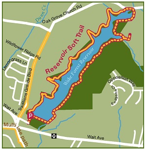
The existing soft trail is on the western side of the Reservoir. Use of the spillway to cross the reservoir is NOT PERMITTED. Any soft trails or trail markers on the eastern side of the trail have not been created nor approved by the Town of Wake Forest.
Trail Type
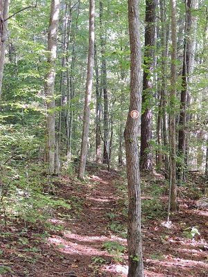
Soft trail, natural surface
Length
1.6 miles one way (Boat Ramp to Oak Grove Church Road), 3.2 miles round trip
Time to Complete
2 hours to 3.5 hours
Parking
A gravel lot is located at the southern end of the reservoir. The driveway to the lake is located off of Traditions Grande Boulevard near Wait Avenue.
 History
The Wake Forest Reservoir was created as a drinking water source for the Town in the early 1960s (Connections – 100 Years of Wake Forest History by Carol W. Pelosi). The lake is open for paddle and electric powered boats. There is a small concrete boat ramp adjacent to the parking area.
Shortly after the City of Raleigh utility merger, the water plant was taken off line, but limited operations are still in place at the reservoir. You can still see some of the water plant structures on site. Falls Lake has become the primary source of drinking water for residents.
In 2012-2013, the town staff and the Greenways Advisory Board worked with many volunteers, primarily members of the Boy Scout Troop #5, to create over a mile and a half of soft trail on the west side of the reservoir. Portions of this trail were made possible by contributions and efforts provided by JPM South developers. The trail connects the parking lot at the southern end of the reservoir to Oak Grove Church Road. In 2013, Ryan Welker, a student at Wake Forest High School, began constructing a portion of the western side of the Reservoir soft trail to fulfill requirements for his Eagle Scout Project.
In September 2019, the Wake Forest Reservoir's ownership was transferred back to the Town of Wake Forest.
Future Soft Trail
The Town of Wake Forest plans to continue the trail around the east side of the reservoir to complete the loop. In order to complete the trail loop, town staff will work with neighboring land owners to select the ideal location for this trail segment. Other trails will be constructed to provide direct access to this loop from neighboring subdivisions. Connections will also be made to the Dunn Creek Greenway corridor and the Smith Creek Greenway corridor.
